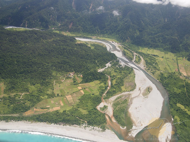
The isolation of Eastern Isabela has always been the lure to explore this remote place. Despite being on the mainland of Luzon, the area is cut off by Sierra Madre mountains. Finally last week, we had the chance to see the region for an exploration and ocular trip as a potential site for our Backpack Photography. After a 12-hour bus ride from Manila to Tuguegarao, we took a SkyPasada 19-seater plane for a 20-30 minutes plane ride to Maconacon. Flying in was already an experience. Seeing the lush forest of Sierra Madre Mountains and the beautiful coastline of Isabela was nothing short of impressive.

We explored Maconacon, the rugged terrain, devastated and ravaged by Typhoon Juan in 2010, is now showing signs of recovery albeit the changes on its landscape. A cancelled flight also gave us an opportunity to visit Divilacan, which left us wanting to explore more of this unexpectedly wonderful coastal town. Electricity has a small window for a few hours in the evening, there’s a cell site but is mostly down leaving the regions disconnected most of the time from the rest of the country. Yet this isolation may be also be the remaining charm of these places aside from the gentle yet skill-full Dumagats, an indigenous group of people, still on their nomadic and hunting ways while slowly adjusting to the modern world. Isabela may be one of the last few gems untouched by commercialisation.


Leave a Reply